

Santa Rosa County Hurricane Michael Information
October 9, 2018
[Updated 6 p.m. Tuesday] Here is the latest Hurricane Michael information from Santa Rosa County:
Storm Information as Forecasted by the National Weather Service
- Santa Rosa County remains under a hurricane warning and storm surge watch.
- At 5pm EDT Tuesday, Hurricane Michael was located about 295 miles south of Panama City, FL, and moving north at 12mph.
- Maximum sustained winds have increased to 120 mph, a Category 3 on the Saffir-Simpson Hurricane Wind Scale
- Some additional strengthening is possible tonight, and Michael is expected to remain a strong Category 3 hurricane until landfall in the eastern Florida Panhandle on Wednesday.
- Tropical storm force winds extend up to 175 miles from the center and hurricane force winds extending up to 45 miles from the center.
- Michael is forecast to weaken after landfall and become a tropical storm over Southwest Georgia on Thursday, then quickly move across Georgia, South Carolina and North Carolina on Thursday before emerging into the Atlantic Friday morning.
- For more information, visit www.nhc.noaa.gov/#michael.
- Santa Rosa County Emergency Operations Center is currently at a Level 2 and is staffing the EOC overnight.
- The Santa Rosa Commission approved a Local State of Emergency at 9 a.m. on Mon., Oct. 8. A local state of emergency allows for the county to request assistance if needed and gives staff the approval to activate emergency plans without going through a formal board approval process.
Evacuations and shelters
- While Santa Rosa County is not forecast to receive any significant flooding or storm surge, the county is forecast to receive tropical storm force winds. Sustained tropical storm force winds could require the closure of some bridges including the Navarre Causeway. Thus, residents of mobile homes, in campers or at campsites or in low-lying areas as well as Navarre Beach are recommended to evacuate. A recommended evacuation is a request for evacuation.This is not a mandatory evacuation.
- Residents in those areas are encouraged to seek refuge on their own initiative and independently find accommodations in a safe area.
- Residents who choose to evacuate are reminded that you need not travel outside the county. It is often easier to shelter with family or friends who live outside the called evacuation zones, a hotel or a public shelter.
- The Milton Community Center, located at 5629 Byrom Street in Milton is pet-friendly and also equipped to accommodate those with special needs. Pet owners must stay with their pets. Those with special needs must come with their own caregiver. Pet owners and special needs residents should be registered with Santa Rosa County.
- Bring the following supplies with you to the shelter:
- Wallet/purse (including personal identification
- House and car keys
- Eyeglasses
- Medications
- Proper clothing
- Family pet(s)
- Three days’ worth of personal supplies to meet individual needs of your family and pet(s).
- Toiletries and personal items.
- Blankets or sleeping bags.
- Games or toys for children; books for adults.
- Special items for infants or elderly family members.
- Any special dietary needs.
- Food and water for the first 24 hours
- Shelters are opened to ensure your safety. Remember they are crowded and usually uncomfortable. It is recommended that other arrangements be made to stay at a hotel or with a friends or family in a well-constructed home out of the evacuation area that is properly protected to withstand hurricane force winds.
- Anyone needing transportation assistance to a shelter, call (850) 983-4636. We will only provide transportation to a designated shelter.
- The shelter is currently hosting approximately 45 in general population, five in special needs and four pets. The shelter will be open until Thurs. morning.
Santa Rosa County Offices and Services
- Santa Rosa County BOCC, Clerk of Court, Tax Collector, Property Appraiser and Supervisor of Elections offices will remain closed Wed. Offices will reopen Thurs.
- The BOCC Regular Meeting scheduled for Wed., Oct. 10 has been cancelled.
- Lifeguards will not be on the beach Wed., Oct. 10.
- Libraries are closed Wed., Oct. 10.
- Animal Shelter drop boxes will closed through Wed., Oct. 10
- Building inspections will be delayed this week. All inspections will be suspended Wed., Oct. 10. Delays are still likely through the end of the week.
- Central Landfill will remain closed Wed., Oct. 10.
The Transportation Disadvantaged program has been suspended for Wed., Oct. 10. Service will resume on Thurs., Oct. 11. For information, call 850-626-6806. - The Navarre Pier will be closed Wed., Oct. 10.
NAS Whiting Field
- NAS Whiting Field is open to mission-critical personnel only on Wed., Oct. 10. the base medical clinic and pharmacy will be closed and reopen Thurs., Oct. 11 at 7 a.m.
Waste Pro
- Navarre – Collection services have been suspended for Wed., Oct. 10. Services will resume Thurs., Oct. 11. If your garbage is normally serviced on Wed. you will be serviced Sat. Recycling and yard waste collection will run one day behind. Wed. will be service on Thurs., Thurs. serviced on Fri. and Fri. serviced on Sat.
- Gulf Breeze – Collection services have been suspended for Wed., Oct. 10 and will resume Thurs., Oct. 11. All collections will run one day behind for the remainder of the week.
- Offices will reopen Thurs., Oct. 11; call 850-365-1900 with any questions.
Courts
- State courts in Escambia, Santa Rosa, Okaloosa and Walton Counties will be closed at noon on Tues., Oct. 9 and will remain closed Wed., Oct. 10. Any further decisions regarding court operations on Thurs., Oct. 11, will be announced as soon as possible.
- First Appearances set for Oct. 10 will be held at 7:30 a.m. at the Santa Rosa County Jail.
- Any detention or shelter hearings set for Oct. 10 will be conducted in Escambia County in conjunction with the Escambia County hearings.
- Domestic violence Injunction hearings set for Oct. 10 are rescheduled to Oct. 17.
- VOP hearings before Judge Hilliard set for Oct. 9 are rescheduled to Oct. 24 at 2:30 p.m.
- Misdemeanor arraignments set before Judge Giraud on Oct. 9 are rescheduled to Oct. 30 at 1 p.m.
- VOP hearings before Judge Giraud set for Oct. 10 are rescheduled to Oct. 31 at 8:30 a.m.
- Docket day before Judge Giraud set for Oct. 10 is rescheduled to Oct. 17 at 1:30 p.m.
- The truancy docket before Judge Ross Goodman set for Oct. 10 is rescheduled to Nov. 7 at 3 p.m.
- Criminal motion hearings before Judge Rimmer set for Oct. 10 are rescheduled to Oct. 15.
- For further updates, follow the First Circuit at https://twitter.com/1stCircuitFLor @1stCircuitFL or visit www.firstjudicialcircuit.org.
City of Milton
- City of Milton offices will remain closed Wed. Offices will reopen Thurs.
- City garbage services will resume Thurs. normal schedule.
Supervisor of Elections
- The Santa Rosa County Supervisor of Elections Office is closed. The closure will affect the voter registration deadline. In Florida, registration books close 29 days prior to an election.
- Due to the office closing early, paper voter registration applications for the 2018 General Election will be accepted on the next full business day the office is open.
- Voter registration applications can be summited online at www.votesantarosa.com. The deadline to accept online voter registration applications will remain 11:59 p.m. October 9.
- Address changes can be made after the books close. If you are unsure of your registration status, visit VoteSantaRosa.com and click on “My Registration Status.”
- Early Voting begins October 22 in Santa Rosa County.
- Questions? Call the Elections Office at 983-1900.
Santa Rosa Public Schools
- District schools and offices will remain closed Wed., Oct. 10.
- A decision regarding school-related afternoon and evening activities for Wed. will be made during the day on Wed.
- A decision on school operation for Thurs., Oct. 11 will be announced on Wed.
- Monitor the district website and local media outlets for updates, as any change to the current forecast track will necessitate changes to the current plan of action.
Pensacola State College
- PSC will remain closed through Wed., Oct. 10. This closure includes all classes, evening classes, school activities, and online classes.
- PSC is scheduled to resume normal operational hours on Thurs., Oct. 11. If that should change, students, faculty, and staff will be notified through the PSC Alert System, social media, PSC website, and local media.
Council on Aging of West Florida
- COAWF will suspend all services Wed., Oct. 10 including:
- All senior dining sites in Escambia and Santa Rosa counties will be closed Wednesday.
- The Retreat adult day care will be closed Wednesday.
- Foster Grandparents and Senior Companions will not report to their schools or client homes Wednesday.
- Meals on Wheels will not be delivered on Wednesday, but will be delivered on Thursday. Clients scheduled for Wednesday delivery will be notified about the delivery change.
- The main Council on Aging office will be closed Wednesday, though the agency’s answering service will remain in operation, able to note questions and needs for service.
Gulf Islands National Seashore
- The Fort Pickens, Perdido Key, Santa Rosa, and Okaloosa Areas are closed.
Florida Forestry Service
- Florida Forest Service offices, recreation and day-use areas in Escambia, Santa Rosa and Okaloosa counties will be closed through Thursday.
Department of Health in Santa Rosa County
- Locations will remain closed through Wed., Oct. 10. The closure includes all DOH-Santa Rosa clinics as well as the Pro Med Dental clinics in Milton and Midway. Services are scheduled to resume at their regular times on Thurs., Oct. 11.
- Call the Milton location at 850-983-5200 on Thurs. to reschedule clinic appointments. To reschedule dental appointments, 850-564-2248.
- Pine Forest and Carroll in Milton
- Citrus and Leisure in Navarre
- Tiger Point Park in Gulf Breeze
- Pace Fire Rescue in Pace
- The tolls for Garcon Point Bridge have been lifted until further notice.
- J. Earle Bowden Way/399 is closed between Navarre Beach and Pensacola Beach.
- Choctaw Field Rd. will remain closed until future notice.
- Heavy rain may quickly flood low-lying areas including roads and bridges.
- Standing water creates a serious road hazard, even when only a portion of the roadway is flooded. Turn around, don’t drown!
- Dangerous road conditions can be reported to (850) 983-5372.
- Bridges will be closed by law enforcement or FDOT at the onset of sustained tropical storm force winds of 39 mph. BRIDGES ARE NOT CLOSED IN ADVANCE.
- County road and bridge closures are posted online.
- Florida road closures are available at www.fl511.com or a free phone call to 511.
- FDOT has suspended interstate and highway maintenance and construction indefinitely to allow for an increase in traffic as motorists evacuate from the northwest Florida coastline area. Bridge inspection crews are on standby for any potential inspections.
- FDOT will assist first responders with traffic control, detours or road closures, but the department will suspend emergency response activities if Hurricane Michael’s sustained winds reach tropical storm force of 45 mph or higher. Once conditions improve, crews will go back to working around the clock to clear all roadways.
- Please do not call 9-1-1 to report power outages. Power outages should be reported to Gulf Power at 1-800-GU-Power (1-800-487-6937) or Escambia River Cooperative, Inc. at 1-877-OUT-EREC (1-877-688-3732).
- Do not use a landline or run water during lightning storms. Do not take a bath or shower. Currents from lightning can enter through plumbing or water lines.
- Unplug sensitive electronic appliances to protect them against power fluctuations that can occur when power is restored.
- Wait five to 10 minutes before turning on appliances and heating/air conditioning systems after power is restored.
- Check for electrical damage such as frayed wires, downed power lines, sparks or the smell of hot or burned insulation. If you find such damage, don’t turn your power on until service crews have made repairs.
- If power lines and poles are down in your yard or in the street, always treat them as if they were energized.
- An electrician must repair damage inside your house. Your electric utility can only hook up power from the pole or underground line to your home. Utility personnel cannot repair your fuse or breaker box, or make other repairs inside your home.
- If your electric service is out, check with your neighbors to see if they have power. If they do, you may have a blown fuse or tripped breaker. Never replace a fuse or reset a breaker with wet hands or while standing on a wet (or even damp) surface.
- Helping line crews is appreciated, but working with power lines and electricity requires a high degree of training. To restore power with the highest degree of safety, restoration must be accomplished in a certain order, using specific equipment and procedures. Workers will appreciate your patience and understanding.
- Residents with storm damage can report damage online including submitting photos at www.santarosa.fl.gov or by calling (850) 983-4636.
.
Voter Registration Deadline Extended Due To Michael
October 9, 2018
 The in-person voter registration deadline has been extended due to Hurricane Michael.
The Escambia County Supervisor of Elections Office will close today, October 9, at 3 p.m. and remain closed Wednesday, October 10, due to the potential impact of Hurricane Michael.
The Florida Secretary of the State issued a directive to storm impacted counties allowing for the extension of the voter registration deadline until the day the office reopened to the public following the storm, which means the voter registration deadline will be extended to Thursday, October 11 for dropping off paper applications for the General Election.
The deadline for electronic submissions through the Florida Online Voter Registration website is 11:59 p.m. tonight.
Photos: Getting Ready For Michael
October 9, 2018

 Monday, Escambia County residents were busy prepping for Hurricane Michael…including trips for the store and gas stations for supplies and fuel.
Many stores were out of water, while there were scattered reports of gas stations without fuel.
Pictured top: Vehicles being fueled at the Tom Thumb in Molino early Monday evening. Pictured inset: Generators at Sam’s Club on Airport Boulevard. Pictured immediately below: Most of the water was sold out at the Walmart on Pensacola Boulevard in Ensley. Pictured bottom: Water shelves were mostly empty at the Winn Dixie in Cantonment Monday, but several pallets of water were available. Photos by Kristi Barbour and others for NorthEscambia.com, click to enlarge.


Northview JV Chiefs Beat Escambia County
October 9, 2018

 The junior varsity Northview Chiefs ended their season Monday night at home in Bratt with a 6-0 win over the Blue Devils of Escambia County High School (Atmore).
For a photo gallery, click here.
NorthEscambia.com photos, click to enlarge.


Scott Closes State Offices In 35 Counties
October 9, 2018
Gov. Rick Scott said Monday state offices will be closed in 35 counties where he has declared a state of emergency because of Hurricane Michael. Scott said in a tweet that the offices will be closed from Tuesday through Thursday. The 35 counties are Escambia, Santa Rosa, Okaloosa, Walton, Holmes, Washington, Bay, Jackson, Calhoun, Gulf, Gadsden, Liberty, Franklin, Leon, Wakulla, Jefferson, Madison, Taylor, Columbia, Hamilton, Suwanee, Lafayette, Dixie, Gilchrist, Levy, Citrus, Pasco, Hernando, Pinellas, Hillsborough, Manatee, Alachua, Union, Bradford and Baker. Hurricane Michael is predicted to hit the Panhandle or Big Bend region in the middle of the week.
Storm Prep Actions You Can Take
October 9, 2018
There are storm preparation actions you can still take, according to Escambia County.
Review or make a family plan. This includes steps like:
- Knowing your evacuation zone. It is very important that you look up your evacuation zone each year to find out if and when you should evacuate, even if you have looked it up in the past, as zones can change. Most importantly, don’t rely on previous storm experience. Just because you weathered the last storm, doesn’t mean you will weather this one. Look up your address online at myescambia.com/knowyourzone.
- Know where you will go. If you live in an evacuation zone, know where you will go and how you will get there. Will you go to a friend or relative’s home, a hotel, or as a last resort, a public shelter? It is always easier to go tens of miles, not hundreds. Find a list of shelters, including special needs and pet-friendly, here.
- Plan for those with special needs. Make arrangements in advance to accommodate those in your family with special needs like the elderly, children and pets. Always have at least an extra 3-10 days stock of medical supplies, medication and any other special items you may need.
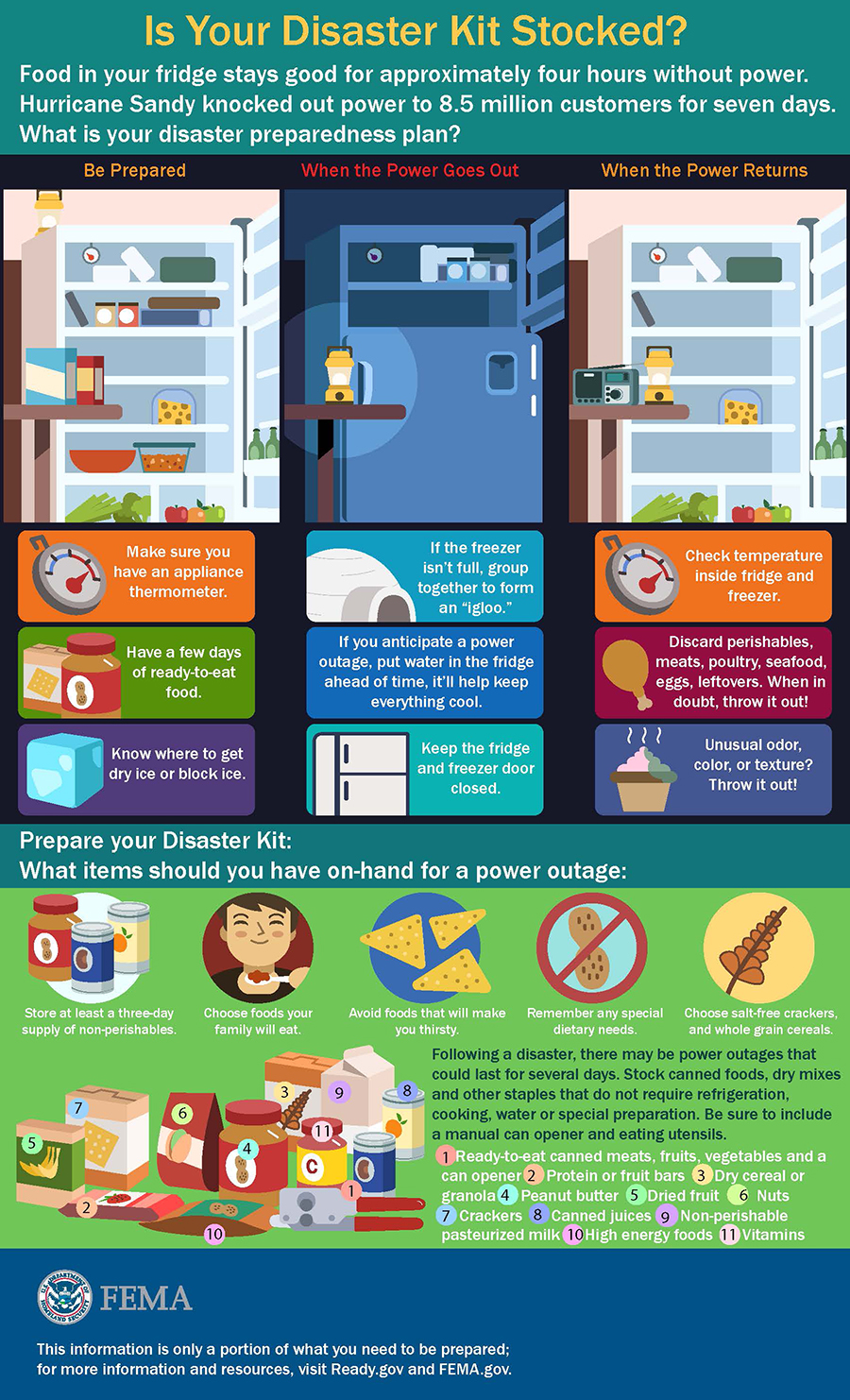
Get a kit - Your disaster kit should have at least three days of nonperishable food and three gallons of water for each person and pet in your home, along with other supplies. Click here to see a disaster guide shopping list.
Stay informed – A tropical system can develop very quickly. Be sure you take time every day to monitor the local media. Escambia County also has several tools available for our residents. Learn more here.
Prep your yard – During hurricane season, it is also recommended that residents take a few minutes to inspect their home and yard. Check for, fix or remove loose items on your home and sheds. Clear loose and clogged rain gutters and down spouts. Learn more here.
Click graphic to enlarge.
Hurricane Closure List
October 8, 2018

Escambia County FL
- Escambia County public schools will be closed a half-day on Tuesday, Oct. 9 and full day on Wednesday, Oct. 10. More info…
- Byrneville Elementary Charter School follows the same closure schedule as Escambia County.
- University of West Florida will close at noon on Tuesday, Oct. 9 and remain closed on Wednesday, Oct. 10. ct. 9 and remain closed on Wednesday, Oct. 10 due to Hurricane Michael. This includes all classes, events, campus activities and online courses.
- Pensacola State College will close at noon Tuesday and remain closed through Wednesday. This closure includes all classes, evening classes, school activities, and online classes.
- All Council on Aging dining sites will be closed Wednesday. Meals on Wheels will not be delivered on Wednesday
- Lighthouse Private Christian Academy will close all their campuses on Tuesday and Wednesday.
- Marcus Pointe Christian Academy will have a noon dismissal on Tuesday, Oct. 9 and remain closed all day on Wednesday Oct. 10.
- Marcus Pointe Christian Preschool and after-school care will dismiss at 4 p.m. on Tuesday, Oct. 9 and remain closed all day on Wednesday, Oct. 10.
- Pensacola Christian Academy is open all day on Tuesday. A decision will be made later about Wednesday.
- The Florida Forest Service is shutting down its operations, offices, recreation and day-use areas in Escambia, Santa Rosa and Okaloosa counties starting Tuesday.
- Century Town Hall will close at noon Tuesday and be closed on Wednesday.
- Santa Rosa County schools will be closed all day on Tuesday, Oct. 9 and extracurricular activities will be complete by noon. Schools will be closed for a full-day on Wednesday, Oct. 10.
- All Council on Aging dining sites will be closed Wednesday. Meals on Wheels will not be delivered on Wednesday
- The Florida Forest Service is shutting down its operations, offices, recreation and day-use areas in Escambia, Santa Rosa and Okaloosa counties starting Tuesday.
- All Escambia County, AL, schools are scheduled to be open on Tuesday. No changes announced for Wednesday.
Escambia County Offers Sand For Sandbag Hurricane Prep
October 8, 2018

Escambia County is offering sand for sandbags for residents living in flood-prone areas. The sand will be available after 9 a.m. and distributed on a first come, first served basis. Residents must bring their own sandbags and shovels to one of the following locations (map):
- Don Sutton Park – 2320 Crabtree Church Road, Molino
- Travis M. Nelson Park – 4541 County Road 4, Bratt
- Escambia County Road Department – 601 Highway 297-A, Cantonment
- John R. Jones Jr. Athletic Park – 555 E. Nine Mile Road
- Equestrian Center – 7750 Mobile Highway
- Ferry Pass Middle School – 8355 Yancey Lane, sand on NW corner of school property on Parazine Street
- Baars Field Athletic Park – 13001 Sorrento Road
- Brent Athletic Park – 4711 N. W St.
When use properly, sand bags can be an effective tool for flooding from a rain event, but not for storm surge. For more information on how to make and use sandbags, visit the Federal Alliance for Safe Homes (www.flash.org). Sand bags can be purchased at most local hardware or home improvement stores, typically for a low cost.
Pictured: Sand made available at Travis Nelson Park in Bratt. NorthEscambia.com file photo.
Escambia Schools: Early Release Tuesday, Closed Wednesday
October 8, 2018

Tuesday will be a half-day early release, and schools will be closed Wednesday in Escambia County, according to Superintendent Malcolm Thomas.
All extra curricular activities are canceled for both days.
Early Dismissal Times:
- All ECSD Elementary Schools will dismiss at 11:00 a.m.
- Middle Schools:
- Brown Barge 12:00 noon
- Ernest Ward 12:35 p.m.
- All other middle schools will dismiss at 12:50-12:55 p.m.
- High Schools:
- West Florida 11:55 a.m.
- Northview 12:10 p.m.
- All other high schools will dismiss at 12:00 – 12:05 p.m.
Although current projections for the storm track for Hurricane Michael indicate that our area may be spared the greatest part of this storm, we are making this announcement now so that parents and staff can prepare,” Thomas said.
Any additional announcements and updates will be posted on NorthEscambia.com.
SANTA ROSA COUNTY:
Santa Rosa Schools will be closed *all day* Tuesday and Wednesday. This is a change from a half day previously announced for Tuesday.
Scott Declares Emergency, State Preps For Michael
October 8, 2018

Gov. Rick Scott on Monday warned residents of the Panhandle and the Big Bend region to “seriously” plan for the impact of the rapidly developing Hurricane Michael, which is expected to reach Florida by mid-week with maximum sustained winds of 100 mph.
“You’ve got to take care of yourself,” said Scott, sporting his faded Navy baseball cap that has become a hallmark of his past emergency attire, after a briefing at the Bay County Emergency Operations Center in Southport.
Scott said emergency officials are “doing everything they can to get everybody ready.” But, as Michael is expected to bring storm surge, rains, flash flooding and tornadoes, Scott said the storm’s northern speed through the Gulf of Mexico is different from hurricanes that have hit Florida the past couple of years.
“This has been different from a lot of the storms we’ve seen since I’ve been governor. It’s fast, this is coming very fast,” Scott said. “It could speed up. It could slow down. We don’t know. And we don’t know exactly where it’s going to hit yet.”
The National Hurricane Center expects Michael to move inland in the Panhandle or Big Bend on Wednesday, and then move northeast Wednesday night and Thursday across the Southeast U.S.
“Steady to rapid strengthening is forecast during the next day or so, and Michael is forecast to become a major hurricane by Tuesday or Tuesday night,” the National Hurricane Center said Monday morning after receiving data from an Air Force Reserve Hurricane Hunter aircraft.
Mark Wool, warning coordination meteorologist for the National Weather Service in Tallahassee, said the storm will be more damaging than Hurricane Hermine, which hit Tallahassee and other areas of the Big Bend in 2016.
“Hermine was a marginal Category 1 storm. We are talking about a significantly higher level of wind,” Wool told The News Service of Florida. “In Hermine, it knocked power out to part of the city (Tallahassee) for a week. There are a lot of trees, not just in Tallahassee, but in all of the surrounding parts of the Big Bend, up into Georgia and over the Panhandle. So, power outages should be expected, and they are going to be of a lengthy duration.”
Wool raised concerns about potential storm surge in Franklin County’s Apalachee Bay, which he described as the “second-most vulnerable stretch of coastline in the entire nation for storm surge, because of the shape of the coastline. It funnels the water right up in there.”
Hermine made landfall in the St. Marks area and moved north through Tallahassee. While it remains unclear where Hurricane Michael will hit, Wool said it would be more powerful than other storms that have damaged the eastern Panhandle and Big Bend.
“There hasn’t been a major hurricane landfall in that part of the Florida coastline since the late 1800s. So, no one alive in this part of the world will have experienced a hurricane of this strength in this part of the state,” he said. “If you think, ‘Oh, I rode out Hermine and I can handle it this time around,’ you might want to reconsider for this one.”
As of 11 a.m. Monday, Michael was about 140 miles east-northeast of Cozumel, Mexico, and 50 miles from the western tip of Cuba.
The storm, moving north at 7 mph, had maximum sustained winds of 75 mph. The National Hurricane Center anticipates the northward motion to pick up through Tuesday night, with a northeast shift expected Wednesday and Thursday.
On Sunday, Scott declared a state of emergency for 26 counties in the Panhandle and the Big Bend, which generally includes areas surrounding Tallahassee.
The state has activated 500 members of the Florida National Guard and has another 5,000 on standby. The Florida Fish and Wildlife Conservation Commission has also designated 40 law-enforcement officers for rapid deployment.
Scott said he also wants local governments to confirm that mutual-aid agreements with electric utilities have been signed so there is no delay in power restoration.
In 2016, Scott clashed with Tallahassee Mayor Andrew Gillum, now the Democratic candidate for governor, over the city’s response to Hurricane Hermine.
Late Sunday, Gillum’s campaign announced he scrapped campaign stops planned Monday and Tuesday in South Florida to return to Tallahassee to “focus on preparing the city of Tallahassee and residents” for the storm.
Gillum’s mayoral office separately sent out a release that said he “reached out to Governor Scott with an update on the city’s efforts.”
Republican gubernatorial candidate Ron DeSantis tweeted that he was redirecting his “Panhandle campaign staff and volunteers to help prepare their communities ahead of the storm.”
Counties along the Gulf Coast were expected to discuss evacuations later Monday.
A hurricane watch, indicating that tropical-storm winds are possible within 48 hours, was in effect from the Alabama-Florida border to the Suwannee River, with a tropical-storm watch extending from the Suwannee River to Anna Maria Island and from the Alabama state line west to the Mississippi-Alabama border.
A storm-surge watch, indicating rising water moving inland within the next 48 hours, is in effect from Navarre to Anna Maria Island, including Tampa Bay.
The National Hurricane Center projected the storm to dump four to eight inches of rain across the Panhandle and Big Bend, with some isolated maximum amounts of 12 inches.
On its current path, Michael could create surges of seven to 11 feet from Indian Pass to Crystal River. The surges would diminish further away from landfall, but even the Florida Keys could get up to four inches of surge.
With agencies preparing for the storm, the Florida Department of Law Enforcement said a meeting this week of the Marjory Stoneman Douglas High School Public Safety Commission had been canceled. The commission, formed after the Feb. 14 mass shooting at Marjory Stoneman Douglas High School in Parkland, had been slated to meet Tuesday, Wednesday and Thursday in Broward County.
Also, Florida State University said in a tweet that it will close Tuesday through Friday.