The Hurricane Forecast Cone Is Getting A Makeover This Year
February 9, 2024
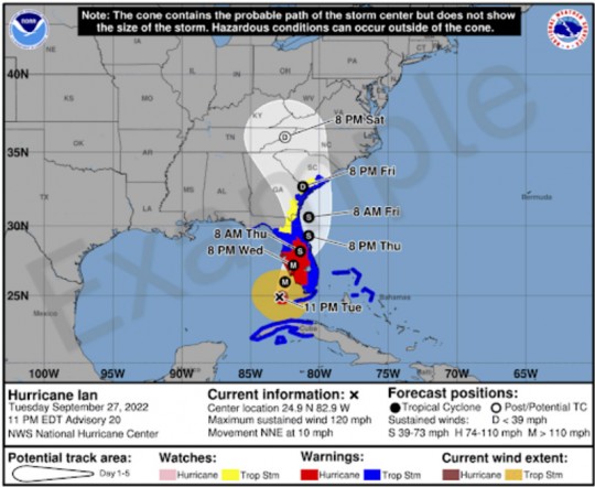
The hurricane forecast cone map is getting a makeover in the middle of this year’s hurricane season.
Beginning on or around August 15, 2024, the National Hurricane Center will begin issuing an experimental version of the cone graphic that includes inland tropical storm and hurricane watches and warnings in effect for the continental United States. Recommendations from social science research suggests that the addition of inland watches and warnings to the cone graphic will help communicate inland wind risk during tropical cyclone events while not overcomplicating the current version of the graphic with too many data layers.
This experimental version will add a depiction of tropical storm and hurricane watches and warnings over inland areas in the continental United States. Previously, the cone graphic only showed watches and warnings in a line along the coastline of the affected area. In addition, the experimental version of the cone will use white transparent shading for the entire 5-day forecast, instead of using white stippling for the 4-5-day portion of the forecast, and the entire outline of the cone will be in white.


Comments