Health Advisory Issued For Water Bodies Including Rivers, Creeks, Gulf
September 16, 2020
Due to excessive flood and sewage overflows caused by the significant rainfall from Hurricane Sally, the Florida Department of Health in Escambia County has issued a health advisory for all inland and coastal waters including local rivers, streams, bayous, bays and the Gulf of Mexico.
DOH-Escambia advises against engaging in any water-related activities due to the potential for high bacteria levels.
The health department will continue to monitor the water quality in these areas and update the public.
Stay Off The Roads: Many Roads Flooded, Water Rescues Underway
September 16, 2020
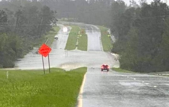
Officials are asking that drivers stay off the roads at this time in Escambia County. Many roads are flooded or have debris on them.
Someone was reportedly rescued after driving into the water pictured here on Highway 29 this morning in Molino.
Photo for NorthEscambia.com
Section Of New Three Mile Bridge Is Missing Following Hurricane Sally; Crane Also Collapses Onto Bridge
September 16, 2020
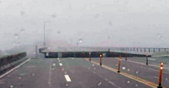
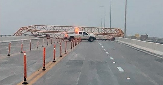
Authorities say that at least one section of the new Three Mile Bridge across Pensacola Bay is missing due to Hurricane Sally.
A large crane fell across the bridge, and there are reports of additional barge strikes.
The bridge will obviously remain closed for a lengthy period of time for repairs. The exact extent of damage won’t be known until conditions improve and engineers can begin inspections.
Photos for NorthEscambia.com, click to enlarge.
Category 1 Hurricane Sally Continues To Hit Escambia County With 80 MPH Winds
September 16, 2020
Winds in Hurricane Sally decreased to 80 mph as of 10 a.m.. The storm made landfall Wednesday in Gulf Shores with winds of 105 mph at 4:45 a.m.
10 AM UPDATE
HURRICANE AND FLOOD WARNINGS CONTINUE
At 1000 AM CDT (1500 UTC), the center of Hurricane Sally was located
by NWS Doppler radar and surface observations near latitude 30.6
North, longitude 87.4 West. Sally is moving toward the north-
northeast near 5 mph (7 km/h), and a north-northeastward to
northeastward motion at a slightly faster forward speed is expected
later today and tonight. A faster northeastward motion is forecast
Thursday and Thursday night. On the forecast track, the center of
Sally will move across the extreme western Florida panhandle and
southeastern Alabama through early Thursday, move over central
Georgia on Thursday, and move over South Carolina Thursday night.
Maximum sustained winds have decreased to near 80 mph (130 km/h)
with higher gusts. Additional weakening is expected as the center
moves farther inland this afternoon and tonight, and Sally is
forecast to become a tropical depression by Thursday morning.
Hurricane-force winds extend outward up to 35 miles (55 km) from the
center and tropical-storm-force winds extend outward up to 125 miles
(205 km).
RAINFALL: Through this afternoon, Sally will produce additional
rainfall totals of 8 to 12 inches with localized higher amounts
possible along and just inland of the central Gulf Coast from west
of Tallahassee, Florida to Mobile Bay, Alabama. Storm totals of 10
to 20 inches to isolated amounts of 35 inches are expected. Historic
and catastrophic flooding, including widespread moderate to major
river flooding, is unfolding
WIND: Hurricane conditions will continue this afternoon within
portions of the hurricane warning area in Florida and Alabama.
Tropical storm conditions will continue in portions of the warning
areas through tonight.
TORNADOES: A few tornadoes may occur today and tonight across
portions of the Florida Panhandle, southeast Alabama, and southwest
Georgia.
NorthEscambia.com will update this story, and the graphics on this page will continually update with the latest information from the National Hurricane Center.
The latest specific information is in the graphics on this page.
High Water Rescues Underway Across Escambia County, Including Cantonment
September 16, 2020
The Escambia County Sheriffs Office, National Guard and Escambia County Fire Rescue are using high water vehicles to rescue people in homes in Bristol Park in Cantonment and neighborhoods off of Blue Angel near Dog Track Road, according to the Sheriff’s Office.
There are reports of people trapped by water across Escambia County.
NorthEscambia.com photo.
National Guard Troops Deployed To Escambia County With High Water Rescue Vehicles
September 16, 2020
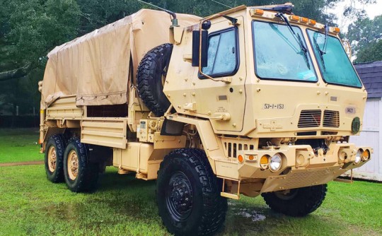
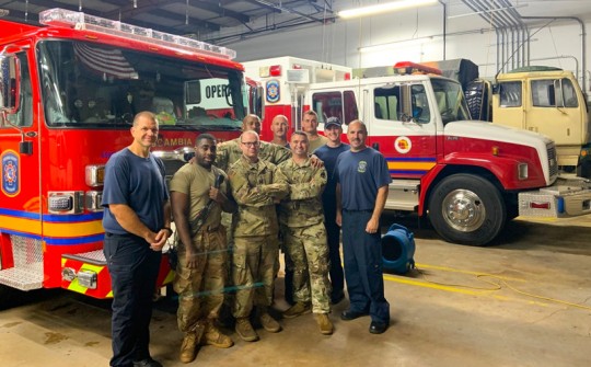
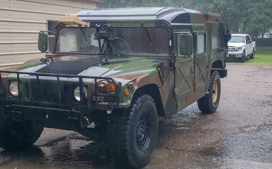
National Guard troops were deployed in Escambia County to assist with Hurricane Sally rescues.
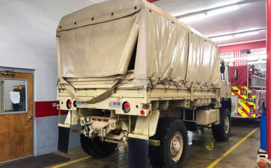
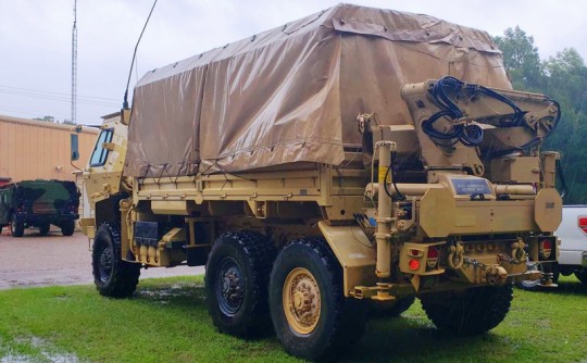
Florida Sen. Doug Broxson said that 125 members of the Florida National Guard were deployed in the county along with high water rescue vehicles. The vehicles were staged at the Escambia Fire Rescue Stations in Molino, Beulah, Ensley, Myrtle Grove, Warrington and the Pensacola fire station on North Davis Highway. The vehicles can be driven through several feet of water.
Tuesday night into Wednesday morning, the National Guard used the vehicles to respond to multiple calls throughout the county alongside Escambia Fire Rescue.
Pictured top: Escambia Fire Rescue Engine 6 “B” watch with a Florida National Guard support unit Tuesday night. Pictured below: National Guard high water rescue vehicles at the Ensley and Molinos stations of Escambia Fire Rescue. NorthEscambia.com and courtesy photos, click to enlarge.
Escambia And Santa Rosa Schools, PSC, UWF And Pensacola Christian Closed Until Monday
September 16, 2020
Public schools in Escambia and Santa Rosa counties will remain closed for the rest of the week.
The University of West Florida, Pensacola State College, Pensacola Christian Academy, and Pensacola Christian Academy will also remain closed until Monday.
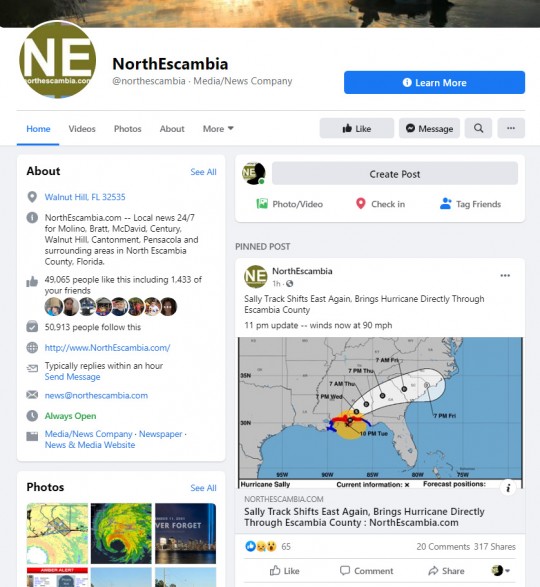
For LIVE Updates, Like and Follow The NorthEscambia.com Facebook Page
September 16, 2020
For live updates from Hurricane Sally, make sure you LIKE and FOLLOW our NorthEscambia.com Facebook page:
https://www.facebook.com/northescambia/
There will be additional updates that may be posted on Facebook that will not be posted here on the NorthEscambia.com website. We’ll keep you updated with the latest important information here on NorthEscambia.com, but check out the Facebook page for frequent extra info.
Here Is The Local Forecast For The North Escambia Area
September 16, 2020
Here is your official North Escambia area forecast:
Thursday: Mostly cloudy with chance of showers and slight chance of thunderstorms. Highs in the lower 80s. Northwest winds 5 to 10 mph. Chance of precipitation 50 percent.
Thursday Night: Mostly cloudy. A 20 percent chance of showers and thunderstorms in the evening. Lows in the upper 60s. Northwest winds around 5 mph.
Friday: Mostly cloudy. A 20 percent chance of showers and thunderstorms in the afternoon. Highs in the lower 80s.
Friday Night: Mostly cloudy. Lows in the upper 60s.
Saturday: Mostly cloudy. A 20 percent chance of showers and thunderstorms in the afternoon. Highs in the upper 70s.
Saturday Night: Mostly cloudy. Lows in the lower 60s.
Sunday: Partly sunny. A 20 percent chance of showers and thunderstorms in the afternoon. Highs in the upper 70s.
Sunday Night: Mostly cloudy. Lows in the lower 60s.
Monday: Mostly sunny. A 20 percent chance of showers and thunderstorms in the afternoon. Highs in the upper 70s.
Monday Night: Partly cloudy. Lows in the lower 60s.
Tuesday: Mostly sunny. A 20 percent chance of showers and thunderstorms in the afternoon. Highs in the upper 70s.
Members Should Contact EREC In Case Of A Power Outage. Here’s How.
September 16, 2020
Escambia River Electric Cooperative is encouraging members to contact them in case of an outage rather than relying on their electronic meters.
EREC’s electric meters are designed to automatically detect and report power outages, but members are asked to report all outages in case the meter signal is obstructed.
Outages can be reported in one of three ways:
- Call the EREC outage number at 1-877-OUT-EREC or 1-877-688-3732.
- • Login to your account via erec.com and click the Outage Tab.
- • Download EREC’s free mobile app through Apple and Android app stores. Login to your account, press the right arrow, and choose Report an Outage from the menu.
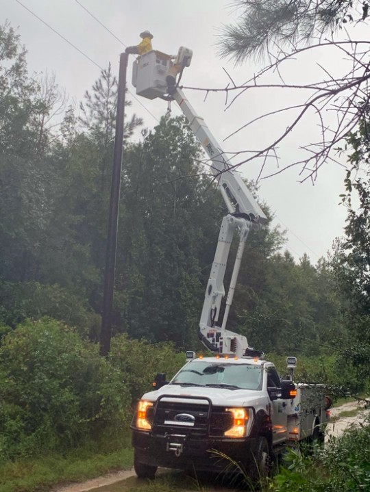
EREC crews will continue to work day and night restoring power as long as conditions are safe.


