The Creek The Changed Course: Nature Class Learns About The Big Escambia
April 9, 2017
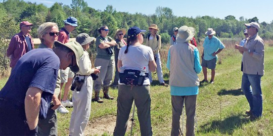
A Florida Master Naturalist conservation class learned about the Big Escambia Creek restoration project near Century last week. The class was presented by a U.S. Fish and Wildlife Service biologist. The class is an adult education program created by the University of Florida/IFAS intended to promote awareness and understanding of Florida’s unique environment.
Big Escambia Creek is a major tributary of the Escambia River located approximately 29 miles north of Escambia Bay. Over 30 years ago conditions along the lower reaches of the creek changed when a sand mining operation digging too close to the creek combined with an intensive rainfall event caused the creek to change its course and follow the path of least resistance through the sandpits. Since the creek changed its course, the estimated 900 acres of wetlands in and around the old creek channel now had no base flow and were reverting to an upland type habitat. In addition, tons of sediment began to flow downstream into the Pensacola Bay System.
A $7.7 million project was implemented to eliminate the delivery of the sediment and to restore the productivity of the floodplain by diverting the creek back into its original channel. Construction on the project began in 2003 and was completed in 2005.
Courtesy photo for NorthEscambia.com, click to enlarge.
Comments
4 Responses to “The Creek The Changed Course: Nature Class Learns About The Big Escambia”


If you are thinking about eating fish caught in the area, go to the Alabama Dept. of Heath and read their fish consumption advisory: http://www.adph.org/tox/assets/Fish_advisory_update_2016.pdf
Don’t know much about the River and Creek erosion, Huh.
It would seem if this project was completed in 2005 then there would not still be sediment going down stream.
Did this project divert all the water back to the stream bed like it should be and entering at the original confluence through the proper wetlands.or is it still filling the ponds on private property and running back into the Escambia River near the bridge on County Road 4?
If one googles the area and looks at aerial photos it looks like a lot of water is NOT going through the proper channel. The map even labels the area Conecuh River at that location.
This needs to be inspected again. Soil and Water Conservation of Escambia County, and District Five Commissioner. Check this out for the health of all down stream.
This is interesting…We’ve noticed over the past few years the lakes filling in with sediment.
Henry bird, Postins bend and half moon have all filled in.
We alway wondered why..now we know