Forest Service Takes To The Air For Forest Management
August 7, 2016
The Florida Forest Service uses aircraft across the state and locally to assist in monitoring and managing forests. Many people are aware how aircraft are used on wildfires and even used on prescribed fires, but other ways aircraft are used include insect and disease outbreaks, forestry Best Management Practices (BMPs), and damage assessments.
After severe weather, such as the February tornadoes, or large wildfires, the Florida Forest Service may send up an aircraft to get initial estimates on size of the area affected and type and extent of damage to both public and private land. This can give estimates quicker, and reduce the need for manpower to hike into possibly unsafe conditions.
When monitoring for BMPs, the forester identifies sites with recent operations from the air. While compliances with certain BMPs can be seen from the air, most require an inspection on the ground. BMPs protect water quality during logging, site preparation, and planting operations. Florida maintains a high rate of compliance with BMPs each year.
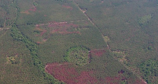
One of the most important flights taken each year is monitoring for southern pine beetle. This beetle can destroy many acres of pine in an outbreak. The Florida panhandle has not had an outbreak since 2001. Each summer, each county is flown in a grid pattern and the forester obtains the latitude and longitude of suspicious looking groups of dead or dying pine trees.
The landowner is contacted and an assessment is made on the ground to confirm or deny the presence of these devastating beetles.
To receive a BMP manual, or cost share assistance for preventing Southern Pine Beetle (must have 10 or more acres of pine trees), or other information, please contact the Escambia County Forester in Molino at (850) 587- 5237.
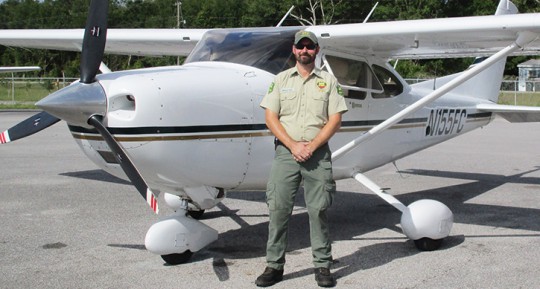
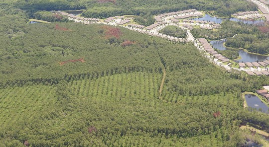
Pictured top: Scott Singletary, Florida Forest Service fixed wing pilot and his aircraft. Pictured below: A southern pine beetle outbreak and, bottom, thinning to help prevent the insect’s spread. Photos for NorthEscambia.com, click to enlarge.
Comments
4 Responses to “Forest Service Takes To The Air For Forest Management”


JJ, a moot point or a mute point??! One is an actual phrase in the English language, the other is a sad mistake. Like “irregardless” or “I could care less”. And, can I call you john?
Seems like the drone operator can communicate to firefighters in much the same way as a plane operator could. So thats a mute point.
Drones can’t verbally communicate real time information to firefighters on the ground and in the air. That alone protects lives and property during a fire and is worth the cost associated with a prop aircraft and a meager State employee salary.
Why aren’t they using mapping drones for this, they would save tax payers a lot of money