Hurricane Season Begins, New Graphic Introduced For 2015
June 1, 2015
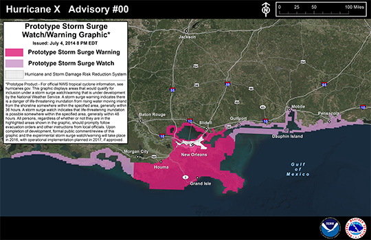
With the new hurricane season today comes a new prototype storm surge watch/warning graphic from NOAA’s National Hurricane Center, intended to highlight areas along the Gulf and Atlantic coasts of the United States that have a significant risk of life-threatening inundation by storm surge from a tropical cyclone.
The new graphic will introduce the concept of a watch or warning specific to the storm surge hazard. Storm surge is often the greatest threat to life and property from a tropical cyclone, and it can occur at different times and at different locations from a storm’s hazardous winds. In addition, while most coastal residents can remain in their homes and be safe from a tropical cyclone’s winds, evacuations are often needed to keep people safe from storm surge. Having separate warnings for these two hazards should provide emergency managers, the media, and the general public better guidance on the hazards they face when tropical cyclones threaten.
NOAA is predicting a “below average” hurricane season for 2015. Click here for more info in an earlier story.


Comments