NOAA Revises Hurricane Outlook
August 6, 2010
It looks like the Atlantic Basin remains on track for an active hurricane season, according to an outlook released Thursday by the National Weather Service. The forecast was issued just before the peak of the hurricane season — late August through October.
NOAA’s updated outlook is projecting, with a 70 percent probability, a total of:
- 14 to 20 Named Storms (top winds of 39 mph or higher), including:
- 8 to 12 Hurricanes (top winds of 74 mph or higher), of which:
- 4 to 6 could be Major Hurricanes (Category 3, 4 or 5; winds of at least 111 mph)
The predictions include the three storms that have already formed this season — Alex, Bonnie and Colin. These ranges are still indicative of an active season, compared to the average of 11 named storms, six hurricanes and two major hurricanes; however, the upper bounds of the ranges have been lowered from the initial outlook in late May, which reflected the possibility of even more early season activity.
“August heralds the start of the most active phase of the Atlantic hurricane season and with the meteorological factors in place, now is the time for everyone living in hurricane prone areas to be prepared,” said Jane Lubchenco, Ph.D., under secretary of commerce for oceans and atmosphere and NOAA administrator.
All indications are for considerable activity during the next several months,” said Gerry Bell, Ph.D., lead seasonal hurricane forecaster at NOAA’s Climate Prediction Center. “As we’ve seen in past years, storms can come on quickly during the peak months of the season. There remains a high likelihood that the season could be very active, with the potential of being one of the more active on record.
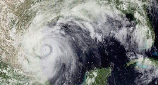
Pictured top: Hurricane Alex, the first named storm of the 2010 Atlantic hurricane season, hits northeast Mexico on June 30.


Comments