

Latest Headlines
- Temperatures Falling Into The 30s Monday Afternoon, 20s For Monday Night
- Church In Molino Destroyed Twice By Fire Decades Ago Suffers Another Fire
- Northview Chiefs Family Mourns Passing Of Their Beloved Toby Weaver
- Need To Get Rid Of A Christmas Tree? You Can Still Recycle It For Free
- Salzman Hosts Blanket Drive for Community
- Congressional Special Primary Early Voting Opens in Under Two Weeks
- Escambia Sheriff, Property Appraiser To Take Oaths Of Office This Week
- Ice Flyers Beat Birmingham 5-2
- ECFR Makes Terminally Ill Cantonment Teen Honorary Firefighter
- Century Native Launches Congressional Campaign In His Hometown With Walking Tour

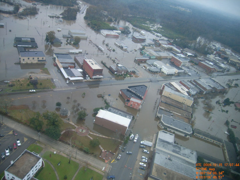
Aerial Photos: Flooding In Flomaton, Brewton
December 16, 2009
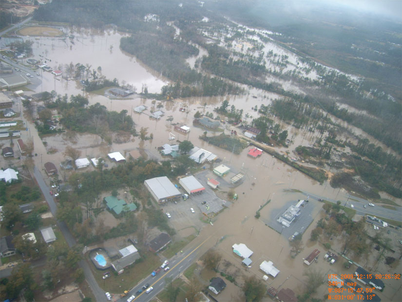
Aerial photos show the extent of the flooding in both Flomaton and Brewton. For more aerial photos from both Flomaton and Brewton, click here. Pictured above: Flooding in Flomaton. Pictured below: Flooding in Brewton. Submitted photos by the Alabama Forestry Commission for NorthEscambia.com, click to enlarge.
Comments
One Response to “Aerial Photos: Flooding In Flomaton, Brewton”
Ah, that new park and walk way brewton built with money that could of been used on the poor roads that helped flood downtown, and man holes everywhere is 100% down the drain nearly. I guess our taxes will just go up more most likely.